The prices and visiting days are available on My week at Les Arcs or at the Tourist Offices.
The Quartier des Alpins in Bourg-Saint-Maurice hosted the Diables Bleus of the 7th Battalion of Alpine Hunters (BCA) until 2012. This memorial site offers an opportunity to discover the Haute Tarentaise valley and the defensive structures built to protect and control communication routes to Italy. It provides a chance to explore the local military history, including its organization, the construction of fortifications, the battles, and the men who gave their lives for our freedom and peace.

«I am Paul, a geographer, I like to look at this valley and think about its evolution and development. A place of passage during the Roman period, it evolved in the Middle Ages with the appearance of seigneuries and borders, becoming a focus of tension and rivalry. I can still make out the scattered remains of the various fortifications. I would like to think that thanks to the unification of Europe, its vocation is once again to link people and facilitate communication.»
FROM THE TOWER… TO THE FORT
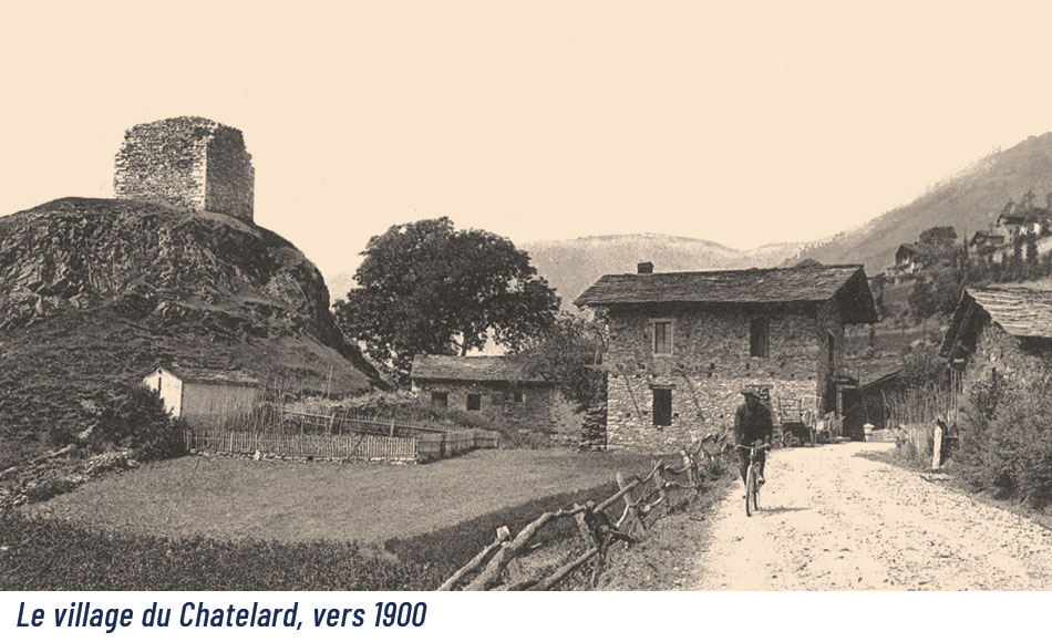
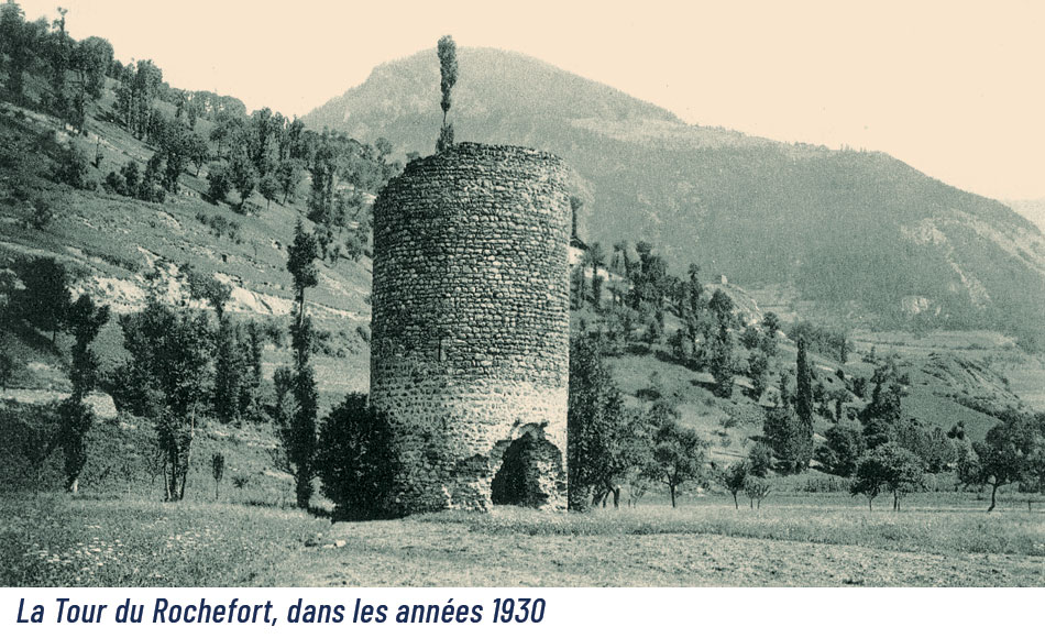
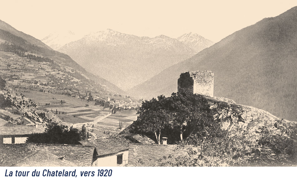
Around the year 1000, the rise of the House of Savoy coincided with the feudal era and the proliferation of fortified castles. In Haute Tarentaise, fortifications ensured control over roads and mountain passes. In Bourg-Saint-Maurice, you can still see the Châtelard Tower (12th century), which occupies a strategic position on a rock at the foot of the Chapieux Valley and facing the Col du Petit Saint-Bernard. Built between the 12th and 13th centuries, the Rochefort Tower is the sole remaining structure of a feudal residence once surrounded by moats and towers. In the 17th century, Louis XIII and Cardinal Richelieu constructed an earthen fort to protect the valley from Piedmontese threats. It has since disappeared.
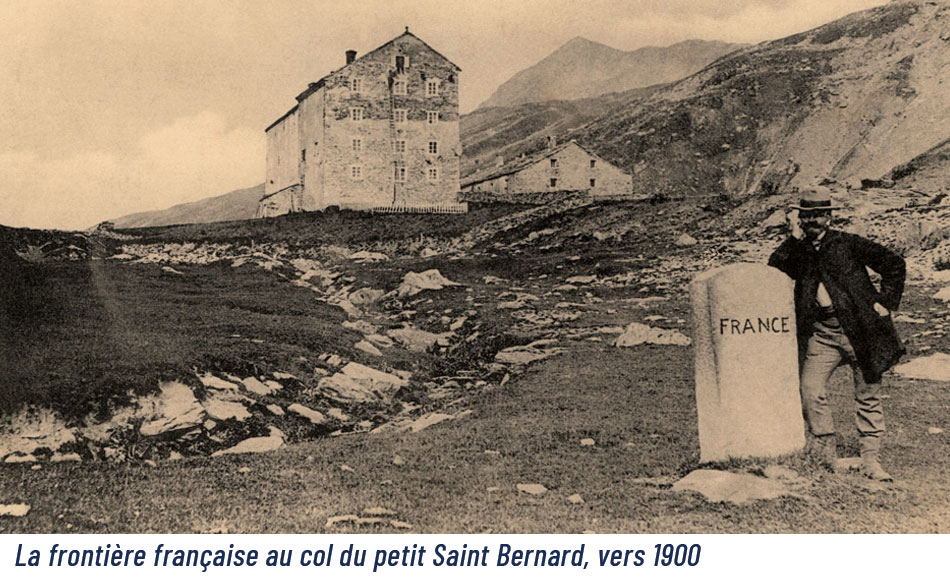
1860, A NEW FRONTIER
After the annexation of Savoy to France in 1860 and the war of 1870, unified Italy became a new threat. In 1888, France created alpine troops as well as a protection system extending from the Jura to Nice: the Séré de Rivières line.
THE MAGINOT STRUCTURES: THE RISE TOWARDS WAR
In the early 20th century, the use of reinforced concrete gave rise to new types of forts and enabled the consolidation of older structures.
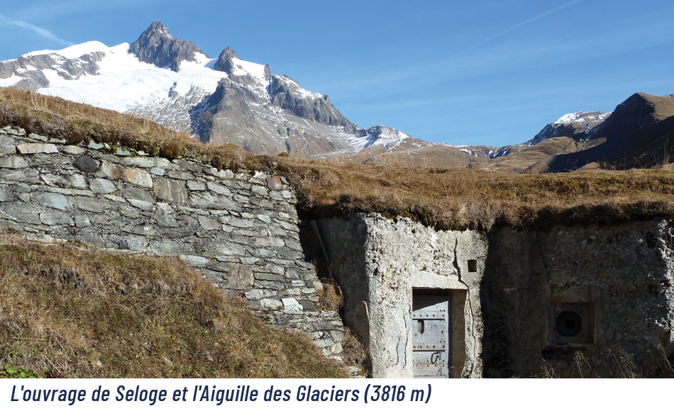
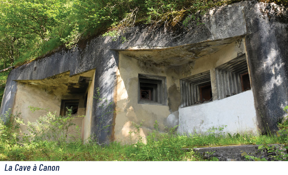
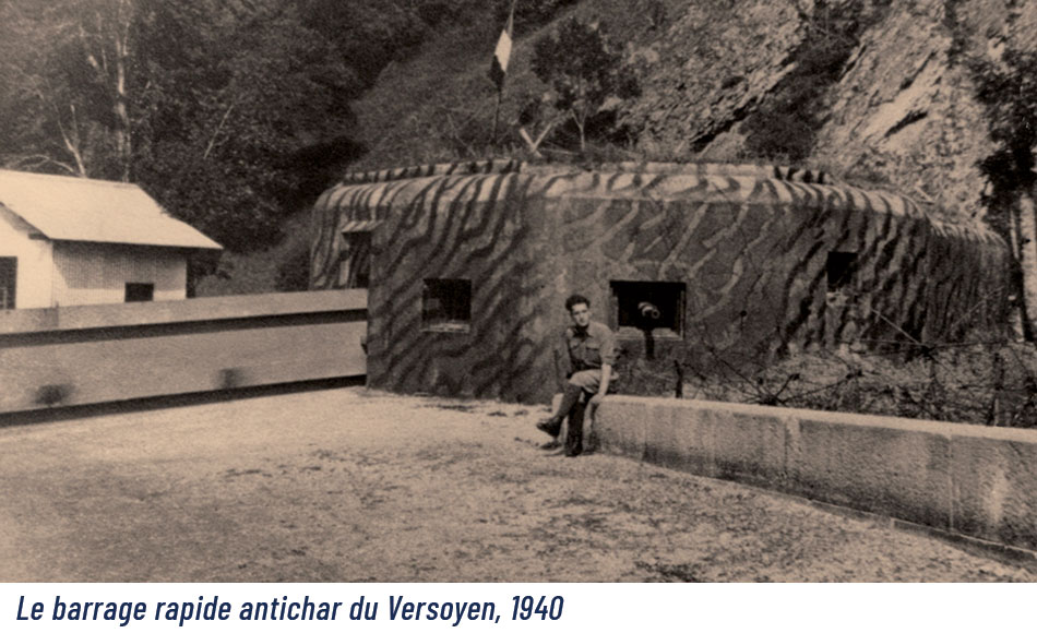
In the late 1920s, the creation of the Maginot Line in the Alps led to several constructions:
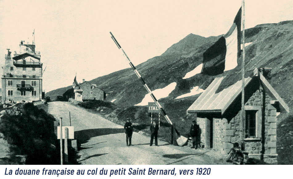
• The Seloge structure at the foot of the Seigne Pass and the lines of small blockhouses around the Petit Saint-Bernard and Mont passes.
• The Canon Cave at the foot of the Malgovert forest, the Châtelard structure at the base of the medieval tower, and the rapid anti-tank barrier of the Versoyen, which has since disappeared.
Barely completed, they were used during the battles of the Second World War. At the end of the conflict, some forts were sold by the military.
THE CHATELARD TOWER
This square tower (7.60m along the sides) and curtain wall (1.80m) are the remains of an ancient defensive system dating from the twelfth century, of which the foundations probably date from the Roman era. Built on a steep promontory at the crossroads of several valleys: Beaufortain, Italy, the Petit Saint Bernard Pass and Isère, it protected all the communication routes. Like all medieval defences, the entrance was a door on the first floor accessed by a ladder to allow easy withdrawal to safety in case of danger. Arrowslits are still clearly visible in the wall.
THE ROCHEFORT TOWER
Built between the 12th and 13th century on a promontory close to the Roman road, this tower is the sole remaining part of a feudal dwelling occupied by a succession of families. Formerly surrounded by ditches and towers, the dwelling was destroyed and buried under mud slides when it was occupied by the Rochefort-Villaraymon Seigneurie.
Dis you know?

PEUTINGER’S MAP
In the Gallo-Roman era Bourg Saint Maurice was called Bergintrum.
It was already an important town in the Roman Empire, as evidenced by its presence on Peutinger’s Map, which shows the entire road network of the Roman Empire: the cursus publicus. Reproduced at the end of the 12th century on a large parchment, it resembles the maps displayed in European metro stations. To this day it still serves as a guide for archaeologists studying the remains of Roman roads and sites.


![[Translate to English:]](/fileadmin/user_upload/headerete2024.jpg "[Translate to English:]")